Photographs by Chate Eamrungroj
-
Here are the exact directions to get you to our annual RCNA crawfish boil held in our beautiful Rattan Creek Park! Keep in mind, this is how things played out in past years. We hope to keep it the same this year. Just please have some patience with us if things don't go exactly according to plan!
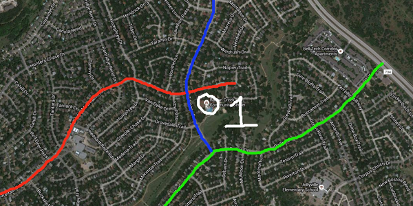
This first image above is more of an overview map to give you a sense of exactly where the Rattan Creek Park Community Center is located. You should know, or easily be able to find, Dallas Dr, Tamayo Dr, and/or Elkhorn Mountain Trail for a frame of reference.
The green line above is Dallas Drive.
The blue line above is Tamayo Drive.
The red line above is Elkhorn Mountain Trail.The white circle with the 1 next to it is the Rattan Creek Park Community Center. We will be very close to this, just to the northeast in the park. Keep going and you will know exactly where we will be.
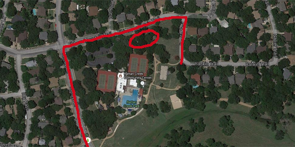
In the second image we approach the park from the air. The red lines show all the street parking available. The Community Center parking lot will fill up fast, so most of us will probably be parking along the street. The red circle indicatss the general area where we will be.
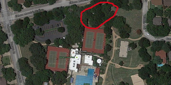
The third picture just blows up the park a bit more and again indicates the general location where we'll be.
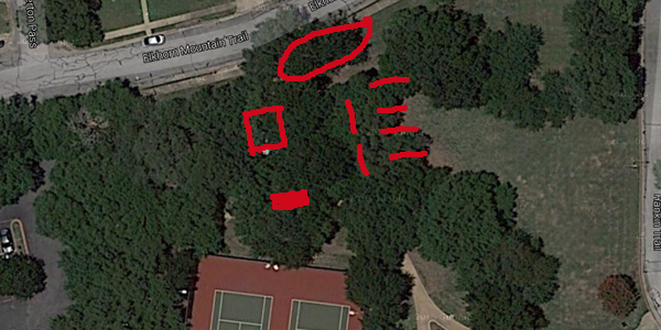
The final image blows up the area of the park where we will waiting for you! The solid red rectangle just above the tennis courts is where the RCNA check-in table will be. When you arrive, stop by and let us know you are! The red square indicates the band area, so we'll keep the front of that clear of tables. The red circle indicates where the cooks will be hard at workto make sure you have plenty of crawfish and assorted accessories to eat. The red lines indicate the feeding area - tables will be set up and loaded up with crawfish for you to put down like the crawfish eating pro you know you are or want to be!
Thus endeth the official crawfish boil location map guide!
Hope to see you at the next one!